 Yesterday's big snowfall (about 6 or 8 inches) transformed our landscape from early spring back to early winter. I walked down to Banfield Park in Victoria West, overlooking the Gorge. The photo above is of the Gorge looking downstream towards the Inner Harbour. That's the Selkirk Trestle (part of the Galloping Goose Regional Trail) in the distance.
Showing posts with label Gorge. Show all posts
Showing posts with label Gorge. Show all posts
Thursday, February 24, 2011
Boats in the Snow
Yesterday's big snowfall (about 6 or 8 inches) transformed our landscape from early spring back to early winter. I walked down to Banfield Park in Victoria West, overlooking the Gorge. The photo above is of the Gorge looking downstream towards the Inner Harbour. That's the Selkirk Trestle (part of the Galloping Goose Regional Trail) in the distance.

Thursday, February 10, 2011
Admirals Bridge
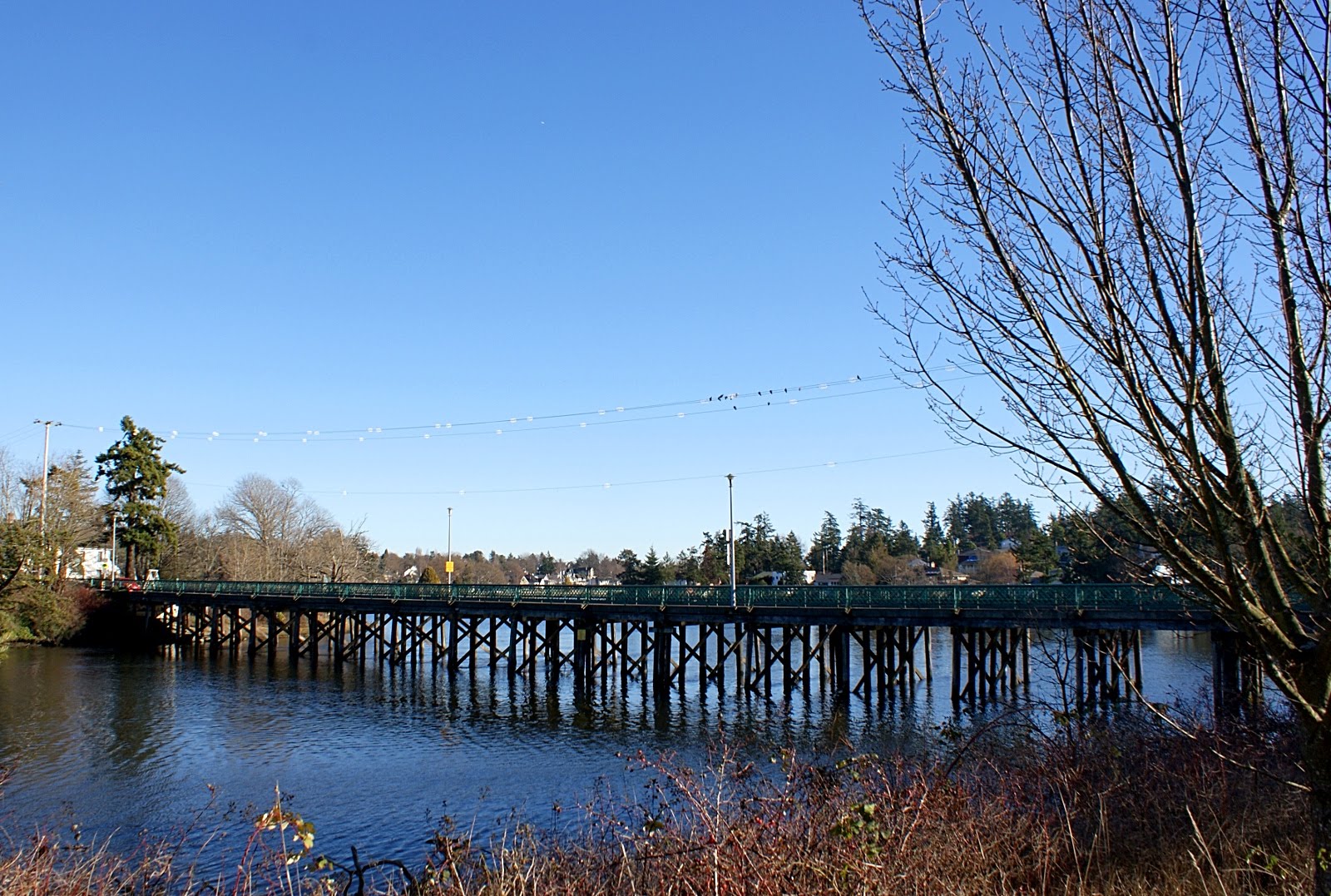 A few days ago I posted a photo of Tillicum Bridge, the fourth bridge to cross the Gorge. Moving upstream westward the next and final bridge is the Admirals Bridge or Admirals Road Bridge. Some time ago I posted a photo taken from this bridge but have not before posted a photo of the bridge itself. VirtualVacationGuide.com has posted a nice 360 degree panorama of this bridge that you can see by clicking HERE. The bridge connects two of Victoria's most significant historical sites, Craigflower Manor and Craigflower School. The school is the white building visible through the trees on the far left of the above photo. Craigflower Manor was directly behind the photographer in the above photo. Both of these sites have been featured extensively on this blog in the past.
Tuesday, February 8, 2011
Tillicum Bridge
 Last month I posted some photos of the Bay Street Bridge, noting that it was the second bridge to cross The Gorge when moving away from the harbor. The next bridge is the Selkirk Trestle, used exclusively by cyclists and pedestrians. The next bridge for automotive traffic is the Tillicum Bridge which crosses the Gorge at a very narrow place called Reversing Falls because of the vigorous tidal currents that change directions there according to the ebb and rise of the tides. In this photo the water is still at nearly high tide. Beneath the bridge on the right is an ancient shell midden.
Thursday, January 6, 2011
Bay Street Bridge III

| From beneath the Bay Street Bridge the view above is looking north and slightly west up the Gorge towards the Selkirk Waters. The house on the opposite shore that is visible through the trees is Point Ellice House. The photo on the right is the view looking in the opposite direction, down the Gorge towards the city. On the left is LaFarge Cement and Butler's Concrete. The large blue building is a thrift store called Valu Village. |  |
Sunday, September 26, 2010
Selkirk Trestle Sunrise
 Residents of Victoria West, like myself, are lucky in that we have access to waterfront both to the north (The Gorge) and to the south (the Inner Harbour). Where I live is about equidistant from the two bodies of water. Usually I have been walking down to the Inner Harbor and along the Westsong Walkway since this offers more expansive views across the Strait of Juan de Fuca to the mountains of Olympic Peninsula. There is often a cruise ship or the Coho car ferry visible as well, while the Gorge is a little more domestic with lots of kayaks and canoes and our local rather diminutive mountains. However, the other morning before sunrise I went down to the Gorge and was pleasantly surprised to find that dawn is like the philosopher's stone that turns everything to gold. There's lots of beauty and interest in the Gorge's smaller scale. The above photo of Selkirk Trestle is nearly a reprise of one I took almost two years ago. This is where the Galloping Goose Regional Trail crosses the Gorge over what used to be a railroad trestle. The Galloping Goose Regional Trail is for pedestrians and cyclists only and is used extensively by a growing number of commuters who prefer to walk, run or ride on two wheels.
Saturday, August 21, 2010
Upper Gorge - Craigflower Manor and School
 This photo is meant to serve as an introduction to the next few days' posts. Here we are looking up the Gorge from the Craigflower Bridge. To the left just out of the frame is Craigflower Manor, one of the earliest extant colonial houses in British Columbia, built in 1856. Off camera to the right and behind me is Craigflower School, the oldest schoolhouse in western Canada (1855). Together they constitute a National as well as a Provincial Historical Site. During my visit I was fortunate to encounter a guide both informed and patient who took me inside both of these old buildings and gave me some insight into their history. Thank you, Cailin Glenn, for the great tour. Between them, these two buildings provide a wonderfully evocative snapshot of life in Victoria's earliest days and tomorrow we'll have a look at them as well as what's behind their doors.
Friday, October 24, 2008
Rainy Days II
 This photo of the part of the Gorge known as the Upper Harbor was taken the same day as a photo I posted on the 14th of October, from the same vantage point but with the telephoto zoom extended to its full 70 mm. I've grown to like this photo much better than the wide angle one I posted earlier. It has a much rainier and wetter feel to it.
Monday, October 20, 2008
Selkirk Trestle
 After passing under the Bay Street Bridge, the Gorge widens into what is called the Selkirk Waters. Here it is bridged by a restored railway bridge called the Selkirk Trestle. The trestle is part of the Galloping Goose Regional Trail and its use is limited to cyclists and pedestrians. At this point the Gorge leaves the industrial area behind (only small boats can pass beneath the trestle) and from here on it passes through residential areas. The photo below is taken just upstream of the trestle from a small park near where I live called Banfield Park.
Tuesday, October 14, 2008
Rainy Days
 Well, today it drizzled all day and was the kind of cold and gloomy afternoon that would have kept me cozily inside in my pre-City Daily Photo Blog life. But I sneered at the weather, leapt on my trusty steed and flew into the teeth of the gale. OK, I compromised by spending most of the afternoon poring through stuff that other people didn't want at my favorite thrift store here in Victoria, but I did have to cycle through the weather to get there. And I took this photo through their back window, that looks out over the Gorge. Those interesting light lines in the sky are the reflections of the florescent lights in the store. I like shopping in thrift stores, especially on rainy days.
On the extreme right of this photo is a red roofed building that has "Point Hope Shipyard" painted on its gray wall facing the Gorge. We will be visiting this shipyard soon.
Sunday, October 12, 2008
The Gorge and Yates Street
 Here's a shot I took a few hours ago from the top of the Yates Street Parkade, with some of the Yates Street heritage buildings in the foreground. That's the Johnson Street Bridge on the left and further up the Gorge is the Bay Street Bridge.
Saturday, September 27, 2008
Further Up The Gorge
I've mentioned before that the Gorge is an arm of the ocean that winds its way through much of Victoria and adjacent communities. I've posted many pictures of the Inner Harbor, the first part of the Gorge. And a couple of weeks ago I posted some photos of Rock Bay, the next part of the Gorge, lying between the Johnson Street Bridge and the Bay Street (or Point Ellice) Bridge. This posting is about the next portion of the Gorge as it moves inland. The photo below was taken from Point Ellice looking down the gorge towards the Bay Street Bridge. The Rock Bay photo posted earlier was taken from the opposite shore just on the other side of the bridge. The sloping walkway here is where one catches the Harbor Ferry, just visible in the distance. This photo is just on the edge of my neighborhood since I live about three blocks from the far end of the bridge and shop at the tan colored shopping center on the far right. The photo below is the view to the right of the photo above and looks up the Gorge towards the Selkirk Trestle - restored for the Galloping Goose trail, not for vehicles except bicycles.
 The sloping walkway here is where one catches the Harbor Ferry, just visible in the distance. This photo is just on the edge of my neighborhood since I live about three blocks from the far end of the bridge and shop at the tan colored shopping center on the far right. The photo below is the view to the right of the photo above and looks up the Gorge towards the Selkirk Trestle - restored for the Galloping Goose trail, not for vehicles except bicycles.
Subscribe to:
Posts (Atom)